Kids of the River Trails: Public Trails
Protection: Town Owned Land.
Description: A short hike with views of the Isinglass and a picnic table.
Trail Length: Less than 1 Mile total.
Difficulty: Easy to moderate, some steep sections
Location: Scruton Pond Road
Activities: Hiking, Cross-Country Skiing, Snowshoeing
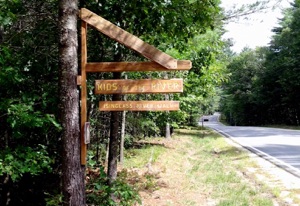
Parking: Parking Lot in front of Property on Scruton Pond Road
Acreage: 18
Motorized wheeled vehicles are not permitted on the Kids of the River Property.
“Kids of the River” land
Original Text Copyright 2008 James H. Schulz, Portsmouth, NH
The Isinglass River flows out of Bow Lake in Strafford, through Barrington, and merges with the Cochecho River near the Dover/Barrington line northeast of town. In 2006, formal action by the New Hampshire legislature and Governor gave the Isinglass River special status as a “designated river.” The designation makes the river eligible for special protection and review related to keeping it healthy and its water of high quality.
Residents of Barrington played an important role in the process. The efforts to get this state designation — which helps protect one of Barrington’s most important natural resources — was spearheaded by a multi-town volunteer group calling itself “The Isinglass River Protection Project.” As efforts moved forward, the group was joined by another group which became known as “The Kids of the River.” A group of Barrington Middle School students and three of their teachers committed themselves to learning about the river and promoting its protection. The Kids of the River were exceptionally well received when they testified before the House committee considering the Isinglass protection legislation.

The Kids of the River Testifying in Concord
Once the river designation was established, the Kids of the River turned to a new project. Many years ago, an 18 acre parcel of land on the Isinglass River reverted to the town because of non- payment of taxes. The town in its wisdom voted to keep the land for future public recreational purposes, and it was this opportunity to which the kids turned their attention. They cleared underbrush to create a picnic area along the river and, with the help of the Barrington Trails Committee, created trails on the property, including leading down to the picnic area and the river.
Directions: The Kids of the River land is off of Scruton Pond Road in the northeast part of Barrington. Going west on Scruton Pond Road from Route 125, the entrance is on the right about 0.5 miles past its intersection with Brewster Road (or 1.5 miles from Route 125). It is on the left about 1.8 miles on Scruton Pond Rd. from Route 202. There is a small staked sign on the right when you get there. Pull off the road into the small parking area.
Trail Description and Directions: From the parking lot, you will see an old town road to the right, marked on the map as “Entry Road.” Walk this road if you must, but it is preferred that you take the Blue Trail (with blue blazes!) that heads into the woods before that. Some of the neighbors abutting the road have been bothered by people right next to their homes, so we try to accommodate their wishes.
After a level stretch, the Blue Trail ascends up to the top of a ledge, where it runs into the White Trail. The ascent is short, but is steep and rugged, so you will have earned the right to puff a bit when you get to the top!
After admiring the ledge top, take the White Trail down to the left from where the Blue Trail
ends. After a short descent you will come to the Red Trail. Take it to the left for a pleasant hike through mixed hardwoods, and you will eventually come to a well-established trail that runs parallel to the Isinglass River. Go left, and very soon you will see a short spur that goes down to a picnic table by the river – an excellent spot to stop and enjoy some refreshment! Remember: Leave no trash.
Return to the main trail and go left (the other way soon leads to private land which is posted “No Trespassing). Enjoy this floodplain forest, and the trail will take you to the old town road (also marked as the Red Trail). A left on that leads to an old bridge abutment with good views of the river. Head back on the old town road towards the parking area, and again it is preferred if you take the White and Blue Trails to get back to your car rather than going straight along the town road.