Stonehouse pond: public trails
Protection: Conserved Land
Description: TBD
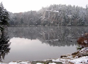
Arguably Barrington’s most spectacular feature is Stonehouse Pond. The 15-acre pond itself, the road to it and the parking area have long been owned by New Hampshire Fish and Game and they maintain the area as a catch-and-release fly-fishing only spot open to the public. It is a designated trout pond in the state, also open for canoeing and kayaking. It is a favorite area for fly fishing, rock climbing and hiking.
In 2010 a long collaborative effort involving the Trust for Public Lands, the Strafford Rivers Conservancy (now the Southeast Land Trust of New Hampshire), the Natural Resources Conservation Service (part of the USDA), and the Town of Barrington came to fruition when some 240 areas of land surrounding the pond was permanently conserved. The property is now owned by the Land Trust and is open to the public for passive recreational activities.
The gravel road to Stonehouse Pond is off of Route 9/202, 5.9 miles west of the junction of Routes 9 & 125, or 3.1 miles east of the junction of Routes 9/202 and 4. Gated part of the year, the road is open from April 1 to October 31. In the off-season one can park at the gate and make the short(~1/4 mile) hike down to the pond. There is a small parking area at the end of the road. As soon as you go a few feet from your car you will be struck by the fantastic view of granite cliffs towering over the pond.
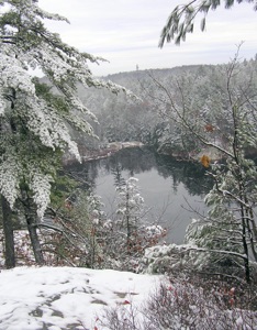
The trail begins to the left of the parking area, just below the dam, where you need to cross the small stream on a few wooden planks. The dam itself does very little to maintain the pond: it was placed at the top of the stream in the 1950s to prevent undesirable fish species from getting into the pond.
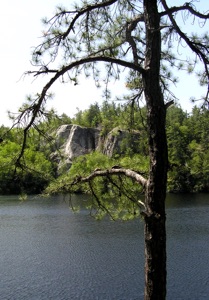
Follow the trail along the pond, enjoying the many views that if affords. When you get close to the cliffs, there are several options for getting up to the top. Hardcore technical climbers can bear to the rights and then go straight up the cliff (don’t do this without some who has experienced this climb and knows the routes!) There’s also a route along the side of the cliff that involves some scrambling up rocks, or there is a more gradual trail further to the left that goes around behind the cliffs and comes up on it from behind. The last is what is shown on the accompanying maps.
The view from atop the cliff is one of the finest in southeastern New Hampshire, but not recommended for those who have a serious fear of heights!
Once you have recovered from the spectacle, retract your steps and you will come to a snowmobile trail leading you to the right and away from the pond. There are less developed trails going down to the far side of the cliff as well.
The snowmobile trail intersects with another trail after about a half mile. Keep to the right, and the trail will eventually lead you back to the road that heads to the parking area.
The total distance of this hike is about 1 1/2 miles.
Click Maps below for Printable-Downloadable Versions.