TurboCam Mallego River Walk: Public Trails
Protection: Conservation Easement.
Description: Turbocam put a portion of their land into this piece of land and created a walking path through it. Flowing out of Richardson’s pond, the Mallego River flows out of Richardson’s pond, heading east and into the Madbury Reservoir.
Motorized wheeled vehicles are not permitted on the Mallego River Walk.
The Mallego River Walk
Text Copyright 2008 James H. Schulz, Portsmouth, NH
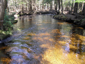
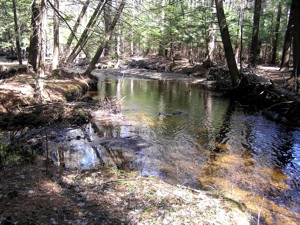
One of Barrington’s many rivers is the Mallego River (aka Mallego Brook). Looking at it, most people would say it looks more like a creek or stream. It is not very wide or deep. Flowing out of Swain’s – Richardson Pond, the river heads east and ends up flowing into the Madbury Reservoir, which is the main source of water for the Town of Portsmouth. Most people who live in Barrington have never seen the river, hidden back from roads or passing unseen under roads. But there is now a good place to get a view of the river, thanks to the Turbocam Company, an international company with a facility in Barrington.
Turbocam launched an automated production systems division in 2001 with a pilot plant capable of round-the-clock unmanned manufacturing of large numbers of centrifugal impellers and blisks (that is, parts for compressors). Robots are used to change parts, and the process is continuously monitored to achieve the close tolerances and surface finishes needed for high performance turbo-machinery applications. By 2004, the pilot plant was deemed successful, and the company then built a new facility – which is in Barrington.
When the facility was built, the company put a portion of the acquired land into a conservation easement and created a walking path through it. The walk is very short – only a few hundred yards. But most of it goes along and over the Mallego River and is quite pretty.
Directions to the Mallego River Walk: Starting from the intersection of Routes 125 and 9, head south on Route 125, passing Turbocam on your left. When you reach the next intersection where Province Road crosses Route 125 (BankNorth on the corner), reverse directions by turning into Province Road. As you now head back north on Route 125, you will almost immediately see roadside metal guard rails marking the highway bridge over the river. Park on the shoulder just before the rails and look for the path going down to the river just before the rails.
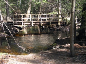
Path Description and Directions: The path goes along the river. There are many snowmobile/ATV trails going off in different directions, so stay to the path going along the river. Eventually you will come to a footbridge going across the river. The walkway continues on the other side and eventually comes out on the road a short distance north of where you parked the car. Return on the shoulder of the road, or you can return the way you came.