Samuel A. Tamposi Water Supply Reserve (SATWaSR): Public Trails
Protection: Conservation Easement
Description: TBDTrail length: ~1 mile to many miles
Difficulty: Easy to moderate
Locations: End of Tibbetts Rd. (off of Hall Rd.), Rte. 125, Carriage Run Rd (from Sherburne Rd., off Hall Rd.)
Activities: Hiking, XC skiing, snowshoeing, hunting. Mountain biking and horseback riding except on signed trails; snowmobiling on Tibbetts Rd. and Power line only
Parking:
1) There is a parking lot at the end of Tibbetts Road, located off of Hall Road 2.3 miles from Rt. 4 on the right, or 1.6 miles from Beauty Hill Road on the left.
2) There is a second parking lot whose entrance is on Rte 125 just north of the Lee line, marked by a green town boundary sign. It’s one mile north of the Lee Traffic Circle, about two miles south of Beauty Hill.
3) You can also park at the start of Carriage Run Rd. (formerly France Rd., ext.), end of Sherborne Rd.
NOTE: the parking areas are not generally plowed in winter.
Acreage: 1513
Wheeled motorized vehicles are NOT allowed on SATWaSR; Snowmobiles only allowed on Tibbetts Rd. and the power line.
SAMUEL A. TAMPOSI WATER SUPPLY RESERVE (SATWaSR)
Original text Copyright 2008 James H. Schulz, Exeter, NH; updated and expanded
“Methinks that the moment my legs begin to
Henry David Thoreau
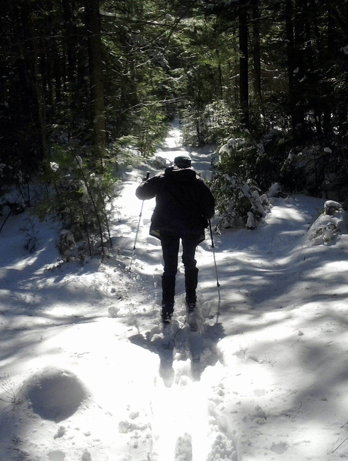
Most of these trails are in fine condition, but the Barrington Trails Committee is in the process of rerouting some which are still in poor shape and can be hard to follow or cross wet areas and can be difficult to traverse. Be cautious. Use of a compass, GPS, and a map is strongly advised. It is a large property, and you can get lost. There are gates at either end of Tibbetts Rd., at the ends of the SATWaSR portion of Carriage Run Rd., and on Rabbitat Rd. next to the power line. These are intended to prevent vehicular access except for snowmobiles along Tibbetts Rd. Should you spot unauthorized motorized vehicles on SATWaSR, please let the town know.
SATWaSR History
In 2001, the Town of Barrington acquired nearly 1,400 acres of land in the southeast corner of town. The acquisition was made possible as a result of a donation from the Tamposi Corporation (the owners) and a grant facilitating the acquisition from the N.H. Department of Environmental Services Water Supply Protection Program. The major purpose of the acquisition was to protect water supplies, as the property contains the headwaters of both the Oyster and Bellamy Rivers. It is officially called the Samuel A. Tamposi Water Supply Reserve (SATWaSR, pronounced SAT’ wasser). It’s permanently protected via a conservation easement held by the Society for the Protection of New Hampshire Forests, and is owned and managed by the Town of Barrington. It is managed for, in order of importance: 1) the protection of drinking water supplies; 2) the preservation and enhancement of plant and animal habitats; 3) public recreation. The communities of Dover, Madbury, Durham, Lee, Portsmouth, and the University of New Hampshire obtain a portion of their drinking water from the rivers passing through this land.
Since the acquisition and protection of SATWaSR, the town has purchased and/or protected several other properties to increase the conservation area, and there are now nearly 2000 acres of contiguous protected land. Conserved areas of this size are rare in southeast New Hampshire, and provide habitat for myriad plants and animals that can’t survive in smaller areas. In addition, the reserve is home to Atlantic White Cedar swamps, rare in this part of the country.
Some of the trails involve wet crossings, so appropriate footwear is advised. The land is open to hunting in season, so hikers are advised to avoid the reserve at that time or to be sure to wear hunters orange.
The trails were named by the Trails Committee at a rather jovial dinner meeting.* Signage for the trails was put in place in 2017; most were made by Barrington Middle School students in shop class.
* Adult beverages were involved.
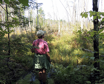
Hikes from the Tibbetts Road Parking area – SATWaSR West (See Map)
The backbone of the SATWaSR trail system is Tibbetts Road, generally accessed via the parking lot off of Hall Rd. The portion of the road that runs through the property was once a class 6 road (town-owned but not maintained), but soon after the town purchased the SATWaSR property it was redesignated as a class A trail. This designation allows it to be gated at both ends, though the gates are left open in the winter for snowmobiles. A walk on Tibbetts is the most straightforward on SATWaSR.
A pleasant ~1.8 mile hike is to simply take Tibbetts Rd. from the gate down to a beaver pond and bridge over a small brook. One item of note is an old cellar hole about ½ mile on the left, just past the intersection with the Cemetery Trail and Rudolph’s Run. This area harbored some of Barrington’s early settlers. If you turn on to the Cemetery Trail, in a couple hundred feet there is a short spur trail to the left that leads to the old Tibbetts (or Tebbetts) Cemetery. There is also a small gravestone in the back of the cellar hole (“Our Alice”) which probably doesn’t belong there – it was likely moved from the cemetery.
A short ways past the cellar hole you will see an extensive vernal pool on your right. Vernal pools are unique wildlife habitats best known for the amphibians and invertebrate animals that use them to breed. Vernal pools typically fill with water in the spring from rainfall and snowmelt, and remain ponded through the spring and into summer. In most years they dry completely by the middle or end of summer. Occasional drying prevents fish from establishing themselves, which is critical to the reproductive success of the frogs and salamanders that rely on breeding habitats free of fish predators. There are numerous vernal pools throughout SATWaSR. If you walk through at the right time of year – general early to mid-April – you will hear the croaking of wood frogs in vernal pools, sounding like the quacking of dozens of ducks! This usually precedes the more commonly heard peeping of spring peepers a week or two later.
A short ways further on you will see a sign directing you off of the main course of Tibbetts Rd. and on to a path to the right marked by red blazes. If you ignore the sign and go straight, you’ll come to a beautiful beaver pond which covers a section of the road. When things are sufficiently frozen, you can just go straight across the swamp, as snowmobilers and XC skiers do. The beaver dam is on the right, but historically it was on the left and the flowage past the dam was able to seep through a stone ford under the road. However, not long before the land was conserved, some yahoos took it upon themselves to knock out the dam. The beavers, employing their native wisdom, rebuilt the dam to the right, flooding the road.
Out in the pond is a dead ‘forest’ with large trees. This is a somewhat unnatural phenomenon, a result of beavers not being part of New England’s wildlife profile for a couple of centuries: they were all trapped out during the fur trade in the 1800s, and did not return in any real abundance until the 1950s. During the long period of their absence, old dams washed away in floods, and the swamps dried up and reverted to forest. When the beavers returned and built new dams, these forests were flooded, killing the trees. In the natural cycle of beavers abandoning and then returning to sites, there generally isn’t enough time for trees to grow so large.
In the dead of winter one can walk or ski right across the old road bed (which is the route for snowmobiles), but most of the year you will need to take the trail to the right to a small bridge that crosses the stream. In honor of the Eagle Scout who created the path and the bridge, the stream is called Bergeron Brook. It’s a lovely spot to sit and revel in the quiet gurgling of the water.
For the 1.8 mile hike, turn around here and head back up Tibbetts Rd.
SB Trail & loop A short walk (about 1 mile) with a good view at the end is the SB Trail (this trail was named after a “Scuzzy Blanket” that was observed next to the trail early in the property’s conservation). It’s the first on your right about a tenth of a mile after you go through the gate After a few hundred feet on it, you will come to a small clearing – the trail continues at the far left corner.
Along the way you will pass the NH state champion Witch-Hazel tree! It is a shrub more than a tree, and its circumference is only 6”, but it is considered a tree by those at the NH Big Trees Program. For information on the Big Trees Program see www.nhbigtrees.org.
If conditions are reasonably dry (and you have waterproof footwear) it’s worthwhile to take the short (~1/10 mile) spur past the intersection with the Black Gum Trail and down to the Creek Pond Wetland. Some of this spur is on privately owned land, so be especially careful to leave nothing.
A look at the aerial photo of the spur shows that it goes out onto a peninsula surrounded by the swamp. When you reach the end of the peninsula, the upper reach of the Oyster River is flowing in front of you. To your right you can see the remnants of an old beaver dam, which in 2017 is still holding back some water. The beavers abandoned the area years ago, but likely will return when a new food source grows back for them. Beavers eat the leaves, bark and twigs of trees such as aspen, willow, and red maple, and a variety of herbaceous plants. During summer months, their dietary preferences may shift to aquatic vegetation including water lilies and rhizomes from shoreline ferns.
Enjoying the SB Trail in winter Although there is a continuation of this trail on the other side of the wetland, don’t attempt to cross it: even in the coldest winter, the flowing water underneath can make the ice deceptively thin.
For the ~1 mile hike, simply retrace your steps back up the SB Trail to Tibbetts Rd. and the parking area. For a slightly longer hike, take the Black Gum Trail to the east. You’ll probably need to hop across a few boulders to cross some wet areas along the early portion of this trail, but once past them you can see a large eastern hemlock tree on the left. This tree was once the largest known of its species in Strafford County, but it has since been dethroned by larger ones.
The trail will slowly hook to the left. Not far from where it rejoins Tibbetts Rd. there is a short side jaunt to another big tree: a former county champion Black Gum (also known as Black Tupelo). These trees, which principally grow in swamps, are the longest-lived broadleaf deciduous trees in North America: several in New Hampshire are over 500 years old, and some have been measured (by taking core samples and counting the rings) at well over 600 years! We don’t know how old this tree is, but it’s a good bet that it predates the American Revolution. The bark of old Black Gums is sometimes described as ‘reptilian,’ but it probably doesn’t go back to the age of the dinosaurs!
You’ll note that the base of the tree is hollow, and you may see evidence of porcupine occupation, i.e. scat (droppings). Despite its hollow base and the chewing of these critters, however, the tree appears to be healthy.
After admiring the tree, return to the Black Gum Trail, go left, go left again on Tibbetts Rd., and the parking area is in about ¼ mile.
Cemetery Trail & loop This loop is about 2 1/4 miles. Start from the Tibbetts Rd. parking area, and go past the gate. About .4 miles in take the cemetery trail to the right; it is just before the cellar hole mentioned in the Tibbetts Road description earlier. In a couple hundred feet there’s a short spur trail to the left that leads to the old Tibbetts Cemetery. Not many of the gravestones are readable, but the Barrington Historical Society has a book about Barrington’s cemeteries that can provide details of this, and other, cemeteries.
In another quarter mile you come to one of SATWaSR’s Atlantic White Cedar swamps. Most of the swamp is on your left, but to the right there are a few cedar trees that are close enough to admire even under fairly wet conditions. Note their vertically striped, fibrous bark, unlike that of any other trees around. If conditions are pretty dry, you can walk a ways into the cedar swamp on the left, which gives an impression, not so much of being in New England woods, but rather more like that found in redwood groves out west.
In fact the largest known Atlantic White Cedar tree in the state is found on SATWaSR, but it’s in a swamp that’s difficult to access. In addition to cedars, the swamp on the left harbors some champion black spruce trees.
Not far after the swamp is the intersection with Conifer Way. The Cemetery Trail continues down to the extensive Creek Pond Wetland, through which the Oyster River flows. The trail gets rather wet if you continue and eventually peters out, but it gives a limited view of the swamp and there’s an interesting blown down tree along the trail, with convenient stepping stones arrayed so that one can traverse the pool that formed when the tree went down.
Conifer way heads back toward Tibbetts Rd. on the other side of the cedar swamp. As the name implies, it is loaded with white pine and hemlock trees, and there are even a few pitch pines.
If conditions are either very dry or very frozen, you can take the Black Spruce Loop, which gives you a chance to get a little ways into the cedar swamp.
When you get back to Tibbetts Rd. turn left, and it’s about 0.8 miles back to the parking lot.
Highland Trail Loop: ~3.4 miles, or shorter loop ~2 miles. Just opposite the Black Gum Trail on Tibbetts Rd., you can take the Highland Trail to ascend the dizzying (well, not very!) heights of Mt. Ripley. For the first half mile or so, the log road that defines most of the trail crosses some wet areas. The Trails Committee has constructed bypasses to avoid these..
When you reach the intersection with Rudolph’s Run, go left to stay on the Highland Trail. In about a quarter mile you will ascend a small hill, taking you to Mt. Ripley (elevation 341 feet), the highest point on SATWaSR. (Supplementary oxygen is not needed.).
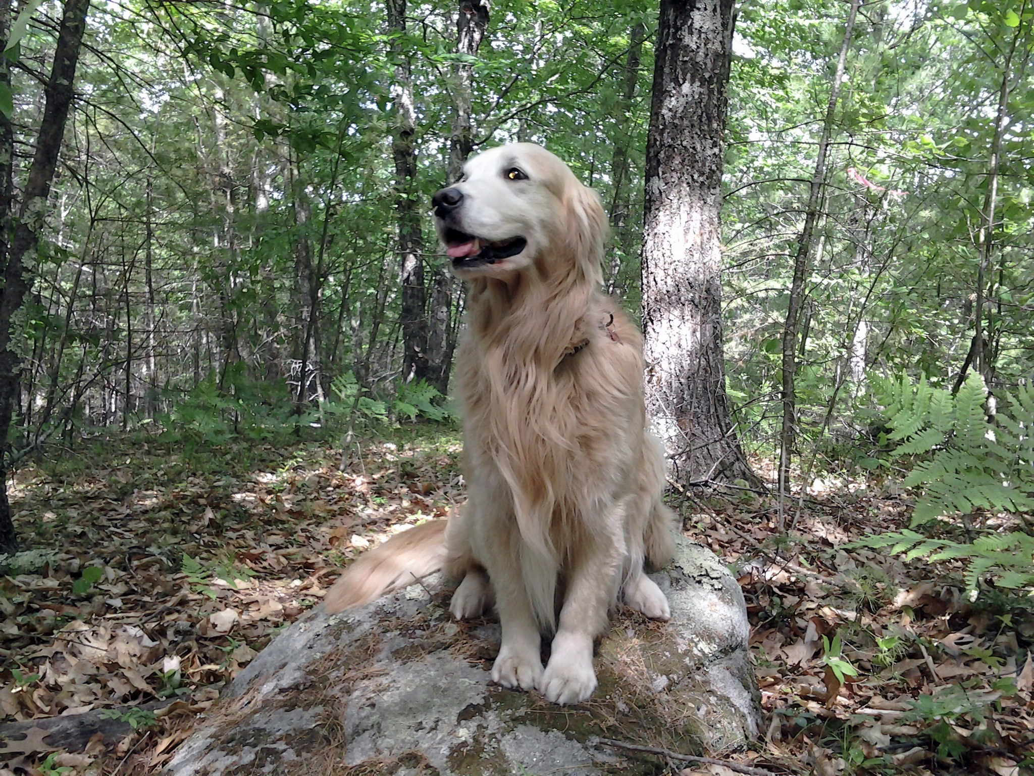
Mt. Ripley was named for the intrepid explorer, a long-time Barrington resident who is the first known individual to conquer the summit.
Ripley (2005-2019) atop his eponymous summit
If you’re exhausted after your long ascent, turn back here, and either completely retrace your steps or take Rudolph’s Run and/or the Santa Claus Trail back to Tibbetts Rd. Much of the Santa Claus Trail runs along the edge of one of SATWaSR’s larger swamps. It was so named because early in the process of the town acquiring the property, a large plastic Santa Claus was found perched high in a tree near the swamp. Remnants of that jolly old elf were still there in 2015. (For an explanation of the naming of Rudolph’s Run, see that for the Santa Claus trail and put two and two together.)
If you want to press on, continue on the Highland Trail until it terminates at the Cedar Swamp Trail. Going right will take you back to Tibbetts Rd. If you go left the trail peters out in about ¼ mile, but will lead to the edge of one of SATWaSR’s cedar swamps.
Hikes from the Route 125 Parking area – SATWaSR East (See Map)
In the fall of 2015 many locals were alarmed by a multitude of logging trucks entering and exiting SATWaSR from its entrance on Rte 125. This was not the despoiling of an iconic New Hampshire woodland, but rather the creation of habitat to protect a species in peril, the New England Cottontail Rabbit! We call it “Rabbitat.”
At that time, the rabbit was close to being declared a federally endangered species (that is not the case at present), so the Natural Resource Conservation Service (a division of the USDA), funded the project. The cottontail requires “early successional habitat,” i.e. low brush and shrubs, in order to thrive. This type of landscape was common in New Hampshire a century ago, but as fields and pasture have reverted to forest it has become increasingly rare.
On SATWaSR nine separate areas ranging in size from about 2 to 15 acres were heavily logged in order to create this kind of habitat. The loggers left slash and debris behind to create the structure that rabbits and other small animals need in order to hide from predators. On a rotating schedule the areas will be recut every 5-10 years in order to keep this type of habitat available.
Hikers in this area will see a vision of what much of New England looked like in the late 19th and early 20th century, when open areas were reverting from being sheep pasture and farm to forest.
After parking, pass the old gate next to the parking area, and you will immediately find yourself on the power line. It is a viable trail in and of itself, though portions pass through some wet areas. Generally preferable is to continue straight across the power line and past the newer gate on the right on to Rabbitat Road. The older gate blocked an old woods road, which was rerouted for the rabbitat project. Rabbitat Road is very wide and was engineered to take the large logging trucks that hauled out the wood from the forestry operation.
In about a quarter mile you will start to see the cleared areas, on both sides. On the right a short ways into the clear cut you’ll see a sizeable boulder with a post sticking up from it. It is a “Picture Post,” constructed by Barrington Trails Committee chair Charlie Tatham. The post is topped by an 8-sided platform, on which you can align your camera or phone to take pictures facing north, northeast, east, etc. You can then send the pictures to a web site formerly maintained by UNH, but now by the University of Oklahoma (https://picturepost.ou.edu/index.jsp/) where they will be posted. In this way changes to the area and its landscape will be documented, archived, and can be viewed and compared for many years to come. There are picture posts in New England and across the country.
Back on Rabbitat Rd., in another ~0.1 miles there is a trail blocked by boulders off to the left, which cuts through one of the rabbitat areas. At this time it is not being maintained, as it just leads to private land that is posted.
Shortly beyond that you will come to a grand crossroads, the intersection of Rabbitat Road and the Cottontail Trail This was the staging area where most of the logs from the surrounding areas were brought to be loaded on to trucks for removal. Boulders and/or debris have been piled at the entrance to each trail to discourage motorized use of these trails, which is prohibited. The Cottontail Trail is blazed with white circles to represent a bunny’s hindquarters.
If you continue straight on Rabbitat Road you will go by a couple more of the clear cut areas, then it will turn into a more unassuming woods road that leads to Tibbetts Road. The old road crosses some wet areas (known to the cognoscenti as ‘Anne’s Puddles’), so small bypasses have been constructed to avoid these. Use the bypasses to avoid mud and water.
A pleasant 2 ½ mile hike is to go left on the Cottontail Trail which will lead down near the boundary of Northern Nurseries, a wholesale plant and landscaping company. A new trail takes you to the right when you get close, and lead to a power line. Note that this is not the same power line that you crossed when you entered from Route 125, so don’t think you can take it back to the parking area! You can follow the power line for about a quarter mile to get to Tibbetts Rd. Make a right there and in about a half mile you will reach the far end of Rabbitat Rd, which you can take back to the parking area. Add an extra half mile to your hike by continuing on Tibbetts up to the Cedar Swamp Trail (see below), then taking it to the Cottontail Trail, which goes back to Rabbitat Rd.
Should you go right onto the Cottontail Trail from the crossroads, you will get to the Cedar Swamp trail, blazed with pieces of red cedar that were left over from construction of a deck. As the map shows, we hope to complete another trail off of this that will run along the edge of one of the rabbitat areas so that you can view it up close – ideally spotting rabbits, bobolinks, woodcocks, and other wildlife that make this habitat their home.
Go left on the Cedar Swamp Trail to head to Tibbetts Rd. A couple of little spurs will lead to views of a cleared area, on the left, and of a swamp, on the right. From Tibbetts Rd. you can return to the parking area via Rabbitat Rd.
Viewing the swamp
Hike from Carriage Run Road. This trail is partially designated as a class 6 road and partially as a trail. It heads through forested areas, across the power line, and ends at a group of houses off of Route 4. Plans are being made to connect it to the rest of SATWaSR (it is separated from it by a large wetland complex that forms the headwaters of the Oyster River), and to the nearby conserved area on the Brasen Hill Farm.
Click Maps below for Printable-Downloadable Versions.